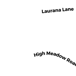
20 HIGH MEADOW RD
Owner Information
DORE C.WAYNE
20 HIGH MEADOW RD
HADLEY, MA 01035


Property Details
20 HIGH MEADOW RD is classified as a Single Family Residential (Modern/contemp).
The primary structure on this property was built in 1996. There are 4,731ft2 of built area within this property. There is 1,927ft2 of residential/living space within this property.
20 HIGH MEADOW RD is valued at $405,600. The land is valued at $151,600 and the structures are valued at $249,300. There is an additional valuation of $4,700 on this property.
This property is in Zone AR. Confirm with local Zoning Board authorities to ensure there are no overlays or other easements on this property.
The most recent deed for 20 HIGH MEADOW RD is recorded at the local registrar in Book 9383, Page 0129. 20 HIGH MEADOW RD was last sold on Thursday, January 31, 2008 for $1.
Assessment data from fiscal year 2021.
Flood Data
According to the FEMA National Flood Hazard Layer, this property does not appear to be in a flood zone. It may also be in an area not yet reviewed. Nonetheless, confirm this information prior to taking any action.
To view the flood hazards around this property, create a FEMA "Firmette" Map of the area around 20 HIGH MEADOW RD.
Broadband Internet Providers
| Provider | Type | Bandwidth (mbps) | |
|---|---|---|---|
| Verizon New England Inc. | DSL | 5 | 0 |
| EarthLink Business, LLC | DSL | 0 | 0 |
| PAETEC Communications, Inc | DSL | 0 | 0 |
| Charter Communications Inc | Cable | 940 | 35 |
| Charter Communications Inc | Fiber | 0 | 0 |
| T-Mobile | Fixed Wireless | 25 | 3 |
| GCI Communication Corp. | Satellite | 0 | 0 |
| HughesNet | Satellite | 25 | 3 |
| VSAT Systems, LLC. | Satellite | 2 | 1 |
| CenturyLink | Fiber | 0 | 0 |
| Viasat Inc | Satellite | 100 | 3 |
Broadband service provider data from December 2020.
Adjacent Properties
- 19 HIGH MEADOW RD
Single Family Residential owned by MORSE JOHN C - 131 ROCKY HILL RD
Single Family Residential owned by CHAMOUN, FARAH - 129 ROCKY HILL RD
Single Family Residential owned by NORTON DAVID P - 133 ROCKY HILL RD
Single Family Residential owned by DWYER CHRISTOPHER P - 18 HIGH MEADOW RD
Single Family Residential owned by PRATS MELISSA A